Mid State Trail, PA

Another beautiful Thanksgiving week along the Mid State Trail, this time it was ushered in with wonderful sunny weather and perfect camping conditions.

As I headed into the woods, I couldn't wait to get lost in the leaves.  The trail, at first, looked like it hadn't been traveled in years.  There was no depression in the earth....only blazes to follow, which I was thankful for!

Not too far into my hike I came upon a beautiful creek, and there I paused to hear what it had to say.  I soaked up the sunshine while I snacked, and let Maple Run tell me the secrets it had been longing to tell since it was last visited by human life.

Maple Run kept tempting me with its tranquil pools and moss-covered banks.

 Maple Run was good to me.

Off in the distance, I could look into the valley and I spotted a small tip of Raystown Lake and its mountain backdrop.

Before the sun began to set that first night, I enjoyed more magnificent views of amber-stained mountaintops.

The next day the trail brought me out of the woods, through farms such as this one, and into downtown Williamsburg, PA.

Williamsburg is home to the Lower (rhymes with 'flower') Trail.  It is an old rails-to-trail bike route, and the MST shares this thoroughfare for nearly 11 miles.

The Lower Trail follows Little Juniata River for most of its length, and crosses side streams that flow into the river, such as the one crossed here on a covered bridge.

The Little Juniata talked to me as well; she had a little more to say than Maple Run. 

I got so tired of these views :) 


I knew it would be damp and cold down along the water, but after 20 miles on the day I didn't have much choice and I camped that night not 10 feet from the river's edge.  I was glad the river didn't rise any through the night. I woke up to frozen fog.

The next morning I had some climbing to do.

 At least the climbing was rewarding.

 As I turned on a trail switchback, I looked back to see where I had come from.

About that time, I gained the ridge and the rocks began.  PA is known for its rocks.  I wouldn't have earth beneath my feet for the rest of my trip.

Ridgetop walking is a lot of fun, but often hard-going and waterless.


The rocks wouldn't give up grabbing hold of my ankles as I walked.

I walked well into dusk, searching for water and camp.

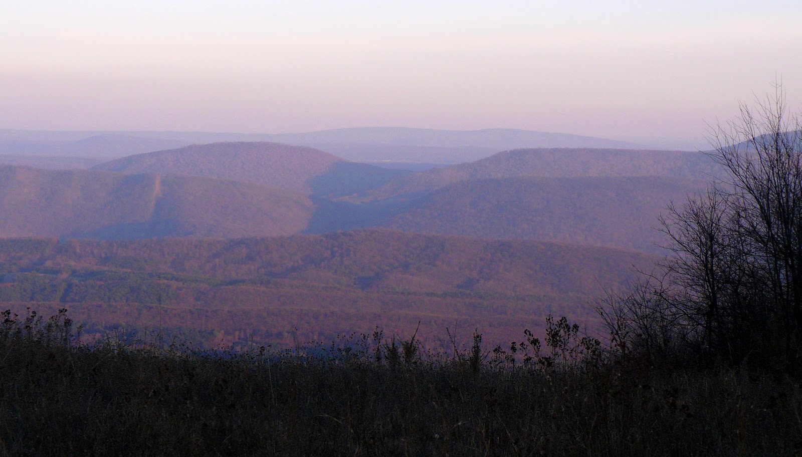
I arrived at camp that night late and beat, but thankful for the blessings of the trail and such a wonderful view right outside my tent door.  

The next morning was equally refreshing, and I enjoyed an early start.

 I looked back to the PA rocks one last moment, and turned to head out of the woods until the next time.

After 4 days in the woods, I made it back to syphilisation just in time for Thanksgiving grub.  I enjoyed a bite from everything.

South Cumberland State Recreation Area

Nice little weekend trip with beautiful weather, ugly comrades, leaf-deafening hikin', and cowboy campin'.

Trails walked:  Stone Door, Big Creek, Connector, North Rim, and Savage Day Loop.
We got in late Friday night, hiked in the dark to a campspot, and crashed after an evening by the fire.  I never left the fire's side all night - you can see my "tent" in the photo next to the ugly Mexican poncho guy.

This was one of the most well maintained trails I've ever traveled - in fact a bit too maintained in places, but nice nonetheless.

 Laurel Creek Falls near Stone Door.

 Stone Door overlook.

We got so tired of this view :)

Descending the many steps of Stone Door.  I did a little illegal off-rope maneuvering to get this vantage point, but don't tell anyone.

 The many steps of Stone Door.

Into the abyss.

 I really wanted to rope up and join the many rock climbers.  May have to come back to get on belay.

 Stick straight trees.

There were many suspension bridges.  Made you feel like Indiana Jones.

 This tree decided to eat an intruder.

Interestingly, as the dry creekbed in the this photo suggests, all the water in the area is not in the Gulf.  It runs along the Rim, down into the Gulf, and disappears underground into the many area sinkholes.  The Gulf creekbeds only run with water during heavy rains.  The Rim creeks are always running.  Flash flooding can be a problem.

Above me is over 100 feet of solid rock.  The water pours out of the rock here in Schwoon Cave, our mid-day source.  Outside the Cave is a 100 foot vertical cliff.

 Water from nowhere.

 Near Schwoon Cave, the ground was covered in green moss and shade loving plants.

One of my favorite times in the day, the light of the late afternoon enveloped us in a sea of yellow. 

Just somethin' about sleepin' by the far.

Okay, so maybe I did do a little rock climbing.  I think I scared my trailmates.  This cliff was about 60 feet high.

Along the North Rim Trail. 

 Notty!

 Along the North Rim Trail.

 Along the North Rim Trail.

 Savage Falls (and a nice swimming hole!)

 Downstream from Savage Falls.